
We’re spending a four day weekend up at our cabin in Strawberry. For my cross-training event today, I took out my mountain bike, and rode out Fossil Creek Road to Forest Road 428 (??), or HardScrabble Road. This is a lovely ride that followed long enough, takes you all the away around Strawberry Mountain into the town of Pine.
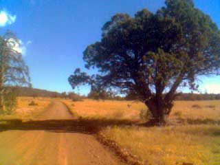
It’s a quiet scecnic gravel road. I took a set of photos with my camera phone (the quality is poor mostly, but serves okay to add to the banner images used on this site). You can view a slide show on my flickr collection Hardscrabble.
Lacking a computer on my bike up here, I carried my Garmin GPS to record the distance, also nice since it does maximum speed and can generate a route map.
The ride out was nice, maybe a bit of a tail wind helping, and not too much effort with the first climbs on Hardscrabble Road. Out at the point where the road marks a hard right to continue, I turned left. The forward direction goes to a private ranch, but the left looked like a challenge of a jeep trail.
It would smoothly past a stock pond, but then turned directly up the cliff. I made it about 3/4 of the way before losing my grip, so I pushed the bike until the jeep trail ended. It looked fairly close to the ridge line, so I ditched the bike in the woods, and followed a smal game trail that continuned upward. It ran out at the base of a basalt cliff edge, but it was easily climb-abie, so I scampered up the 30-40 feet to the top.
And oh what a dramatic view it was, over Deadman Mesa into Fossile Creek, a ride I’d done last summer (a 2000 feet descent). I felt great up here.
It was a quick jaunt down, and a fun descent down the streep gravel. I headed on home, as this was supposed to be a relaxing day out. But oh, once I hhit the main road, I felt out of gas. It was not even pushing too much into the wind, but I was feeling a bi naseous… maybe it was that donaut I guzzled down when I left for extra energy, or maybe it was the 6000 foot altitude, but it was a S-L-O-W ride home, not really championship form.
Still, it was a worthy experience, believe it or not. You had to see that view to appreciate it.
I love hearing about your combination of training and how you use technology to do so! How fun!
Which Garmin are you using to track your route and distance? I’d like to start keeping a training log as well.
My Garmin is an ancient relic, I think it is an eMap that is likely 4 years old:
http://www.garmin.com/products/emap/
It does okay for simple mapping, but offers little to transfer data. Then again, its the same satellites it always was.
Some have recommended the new running ones that fit on your wrist like the ForeTrex
http://www.garmin.com/products/foretrex201/
though they look kind of bulky to me.